
There is no weather situation that I love more than the one that is occurring tonight. It is quintessentially Northwest.
After a period of warm weather, a surge of marine air moves inland, bringing substantial winds and a rapid cool-down.
Best of all, the entrance of the onshore push of marine air is signaled by wind chimes, which are now sounding all over my neighborhood (play the video below!).
Low clouds off the Pacific Ocean are now pushing inland, as indicated by the visible satellite image at 6PM.(see below). But this banquet of weather doesn't stop there, as unstable air over our region is associated with cumulonimbus clouds and thunderstorms moving westward, particularly over southwest Washington and Oregon (see visible satellite image).

During the day on Monday, a key measure of the potential for an onshore push of marine air, the onshore pressure gradient, rapidly increased. My favorite pressure gradient for pushes is the Hoquiam -Seattle pressure difference; when it gets to 4 hPa (hPa is a unit of pressure), a strong push of marine air is inevitable over Puget Sound. Late Monday afternoon it got to 5.2 hPa! (see the plot below). The die was cast.


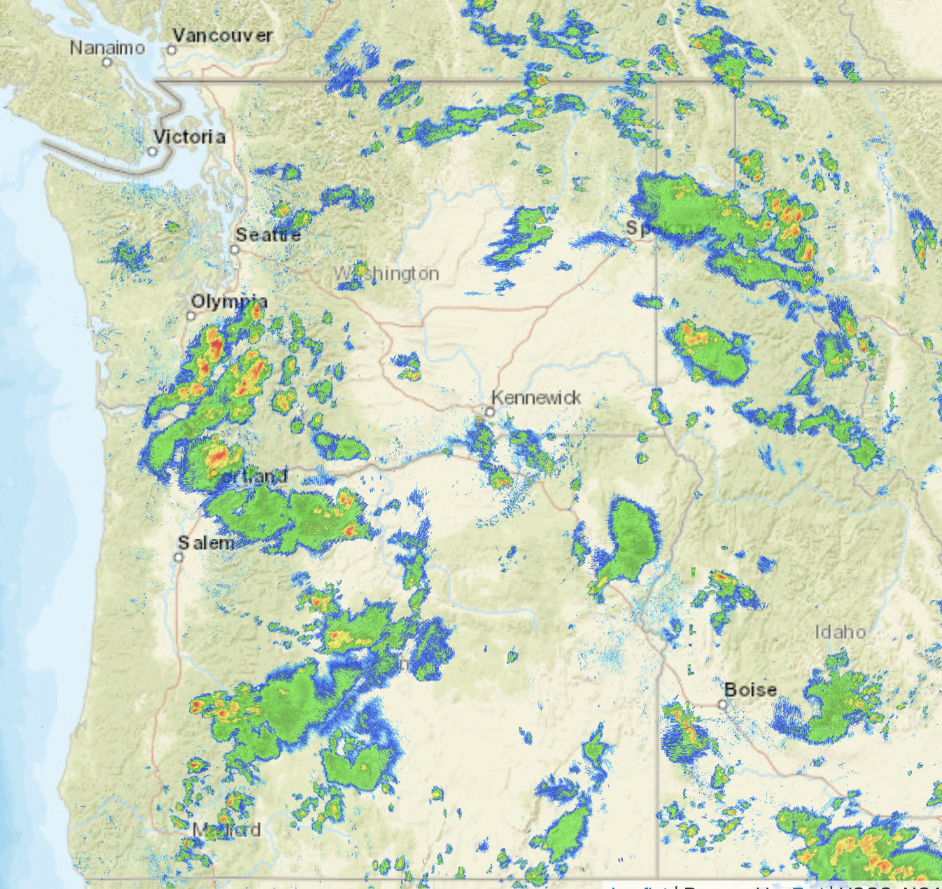
The radar image late this afternoon and evening is all lit up with strong convective showers, particularly between Olympia and Portland, but east of the Cascades got a piece of it (see radar at 5:43 PM below).
As I write this around 9:20 PM in Seattle, I can hear thunder in the distance. In fact, the 9 PM satellite-based lightning mapper shows lightning strokes just to the east of Seattle (see below).

The change in our weather is associated with the weakening of high pressure/ridging to our north and the movement of a weak upper-level low into Oregon (see below). Cold air aloft contributes to instability and thunderstorms since air parcels can become unstable (and thus mix vertically) when the temperature change with height increases.

So if you are living west of the Cascade Crest, open your windows and be prepared for a good night's rest. Cool air and some thunderstorms? What could be better?
.
East of the Cascade crest, you might see some more thunderstorms tomorrow!
In any case, the several days of much above-normal temperatures are over.
____________________
Interested in a free lecture at the UW on How We Will Stop Fossil Fuels From Causing Global Warming by Oxford University Professor Myles Allen? It will take place at 7 PM May 25 at UW's Kane Hall and you can get more info and sign up below. Professor Allen is a very good speaker and internationally very well known; the talk will probably fill quickly so make your reservation soon if you want to go.
